- Home Page /
- Office Products /
- Office & School Supplies /
- Education & Crafts /
- Geography Materials /
- Maps /
- Garmin Delorme Atlas & Gazetteer Paper Maps- ...
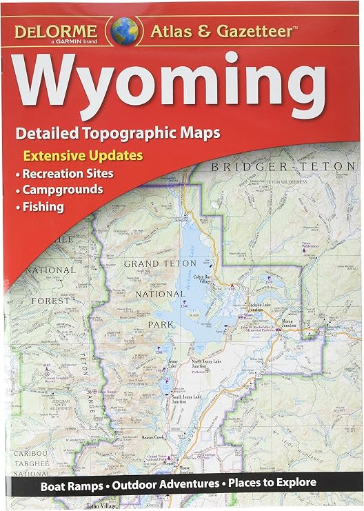
Garmin Delorme Atlas & Gazetteer Paper Maps- Wyoming 010-12694-00
Ubuy works hard to protect your security and privacy. Our advanced payment security system ensures confidentiality by encrypting your information during transmission using AES (Advanced Encryption Standards) and SSL (Secure Socket Layer) protocols. Your payment details are 100% secure as we do not share your payment details with third party sellers.
Delorme Atlas & Gazetteer paper maps: your ultimate trip planning tool.
Fast
Shipping
Free
Return*
Secure Packaging
100% Original Products
PCI DSS Compliance
ISO 27001 Certified

What Stands Out
Product Details
- Large-format paper maps for all 50 States, featuring topographic maps with elevation contours, major highways, roads, dirt roads, trails, and land use data
- Contains essential information for outdoor enthusiasts, including points of interest, landmarks, State and national parks, campgrounds, and more (information varies by State)
- Ideal for sightseeing, exploring back roads, outdoor recreation, and trip planning
- Available in paperback (11 inches x 15.5 inches)
- Reliable resource for trip planning and backcountry access
- Crafted with amazing detail and suitable for various outdoor activities
| Item Weight | 1 lbs (450 grams) |
Who Should Buy?
-
Outdoor Enthusiasts
Perfect for hikers and campers who need detailed topographical maps for navigating Wyoming's diverse landscapes.
-
Road Trip Travelers
Ideal for those on scenic road trips, offering comprehensive coverage and local points of interest for exploration.
-
Emergency Preparedness
Essential for anyone wanting a reliable navigation tool during emergencies when digital devices may fail.
-
Tech-Savvy Users
Not suitable for individuals who prefer digital maps and GPS navigation for real-time updates and convenience.
-
Urban Navigators
Less effective for city dwellers who need precise urban navigation rather than broad regional coverage.
-
Frequent Travelers
Not suitable for those who travel often outside Wyoming, as they may require maps for various regions.
Product Description
Garmin Delorme Atlas & Gazetteer Paper Maps- Wyoming 010-12694-00
Customer Questions & Answers
-
Question:
What are the key features of the Garmin Delorme Atlas & Gazetteer Paper Maps for Wyoming?
Answer: The Garmin Delorme Atlas & Gazetteer Paper Maps for Wyoming offer detailed topographic maps that highlight landscapes, terrain changes, and waterways, making them ideal for outdoor enthusiasts. These maps provide comprehensive coverage of the state, including recreational areas, highways, and minor roads. The atlas also includes GPS coordinates and symbols for hiking trails, campsites, and points of interest. Whether you’re planning a hiking trip in the Wind River Range or exploring the scenic routes of Yellowstone, these paper maps are a reliable resource. -
Question:
Are the Garmin Delorme Atlas & Gazetteer Paper Maps waterproof?
Answer: The Garmin Delorme Atlas & Gazetteer Paper Maps are not waterproof; however, they are printed on durable paper designed to withstand wear and tear. For outdoor use, consider placing them in a plastic map case or plastic sleeve to protect them from rain or moisture. This will help preserve the maps while you explore the rugged terrains of Wyoming, such as the Bighorn Mountains, ensuring you can navigate even in challenging conditions. -
Question:
How can I use the Garmin Delorme Atlas & Gazetteer Paper Maps in conjunction with GPS devices?
Answer: You can use the Garmin Delorme Atlas & Gazetteer Paper Maps alongside your GPS device to enhance navigation accuracy. These maps provide comprehensive geographical context that may complement GPS routes. For instance, when hiking in remote areas with limited GPS signal, the atlas will help you identify topographic features and alternative paths. Mapping out your routes on paper before heading out can also serve as a valuable reference if electronic devices fail. -
Question:
What scale are the Garmin Delorme Atlas & Gazetteer maps printed at?
Answer: The Garmin Delorme Atlas & Gazetteer Paper Maps for Wyoming are generally printed at a scale of 1:100,000. This scale provides a detailed view of the state, allowing users to see streets, landmarks, and natural features clearly. The intuitive scale is suitable for various activities, from road trips to hiking excursions, making it easier to navigate both urban and rural settings throughout Wyoming. -
Question:
Can the Garmin Delorme Atlas & Gazetteer Paper Maps be used for planning off-road routes?
Answer: Yes, the Garmin Delorme Atlas & Gazetteer Paper Maps are well-suited for planning off-road routes. The detailed topography and varied terrain information allow you to identify potential trails and unpaved paths. For example, if you’re planning an ATV or mountain biking adventure in Medicine Bow National Forest, these maps will provide insight into which trails are accessible and their level of difficulty. -
Question:
Do the Garmin Delorme Atlas & Gazetteer Paper Maps include points of interest?
Answer: Yes, the Garmin Delorme Atlas & Gazetteer Paper Maps include a wealth of points of interest such as parks, historical sites, campgrounds, and fishing spots. This feature is particularly helpful for travelers or locals exploring Wyoming, as it gives insights into scenic spots and recreational opportunities. For instance, if you're aiming to explore the beauty of Grand Teton National Park, the atlas will guide you to campsites and scenic overlooks. -
Question:
Are the Garmin Delorme Atlas & Gazetteer maps suitable for all types of outdoor activities?
Answer: Absolutely! The Garmin Delorme Atlas & Gazetteer Paper Maps are designed for a variety of outdoor activities including hiking, camping, fishing, and road cycling. Their detailed layout of trails, rivers, mountains, and recreational areas ensures that they meet the needs of various outdoor enthusiasts. Whether you’re planning a weekend getaway to Bridger-Teton National Forest or a family camping trip, these maps will provide essential navigational support. -
Question:
What is the best way to store and maintain the Garmin Delorme Atlas & Gazetteer maps?
Answer: To maintain the longevity of the Garmin Delorme Atlas & Gazetteer maps, it’s best to store them flat in a cool, dry place away from direct sunlight. Using a protective sleeve can also keep them safe from rips and tears during travel. Proper storage is essential, especially for outdoor activities where maps are frequently accessed. Keeping the maps organized in your car, backpack, or camping gear will make them readily available for your adventures. -
Question:
Can I use the Garmin Delorme Atlas & Gazetteer maps for geocaching?
Answer: Yes, the Garmin Delorme Atlas & Gazetteer Paper Maps are an excellent resource for geocaching enthusiasts. Their detailed features and terrain representations make it easier to spot precise areas where caches might be hidden. Additionally, pairing the paper maps with a GPS device can enhance the geocaching experience, giving you both a visual and digital navigation tool as you hunt for hidden treasures throughout Wyoming. -
Question:
Where can I buy Garmin Delorme Atlas & Gazetteer Paper Maps- Wyoming 010-12694-00?
Answer: You can purchase the Garmin Delorme Atlas & Gazetteer Paper Maps- Wyoming 010-12694-00 from Ubuy. Ubuy is a reputable online platform that provides a wide range of products, ensuring a convenient shopping experience. With Ubuy, you can easily browse and order this essential navigation tool, allowing you to explore the beautiful regions of Wyoming with confidence.
Garmin Maps Editorial Review
Customer Reviews & Ratings
-
5 Star
100%
-
4 Star
0%
-
3 Star
0%
-
2 Star
0%
-
1 Star
0%
Review this product
Share your thoughts with other customers
Platform Trust & Buyer Confidence
“The product received very good packaging & safe…Thank You”
“Accurate delivery timing given”
“Not madly expensive like I thought, and much quicker than promised.”
“Never dealt with Ubuy before, but everything worked out great. Seamless cross border purchasing and shipping. Thanks!”
“The process was smooth, with clear communication and timelines. This was my 1st purchase and I am really impressed. I will definitely be coming back.”
Important information
- Limitations : For products shipped internationally, please note that any manufacturer warranty may not be valid; manufacturer service options may not be available; product manuals, instructions, and safety warnings may not be in destination country languages; the products (and accompanying materials) may not be designed in accordance with destination country standards, specifications, and labeling requirements; and the products may not conform to destination country voltage and other electrical standards (requiring use of an adapter or converter if appropriate). The recipient is responsible for assuring that the product can be lawfully imported to the destination country. When ordering from Ubuy or its affiliates, the recipient is the importer of record and must comply with all laws and regulations of the destination country.
- Not all the products listed on Ubuy are for sale, as Ubuy is a global search engine. Products are subject to export/trade regulations.
Currently unavailable.
We don't know when or if this item will be back in stock.
This item is not restrict in my country.(Please click on above link if this item is not restrict in your country, So our team will review and allow.)
PCI DSS compliant and ISO 27001:2022 certified, with encrypted payments and full buyer protection on every order.
Ubuy Assurance
Experience worry-free shopping with 100% original products, PCI DSS-compliant payment security, ISO 27001-certified data protection, the fastest cross-border delivery, free returns *, and secure packaging on every order.

