- Home Page /
- Sports Outdoor & Fitness /
- Hunting & Fishing /
- Fishing /
- Tools /
- Charts & Maps /
- Topspot N219 Map- Mosquito LagoonN Indian Riv...
0 ratings

Item #:
578435
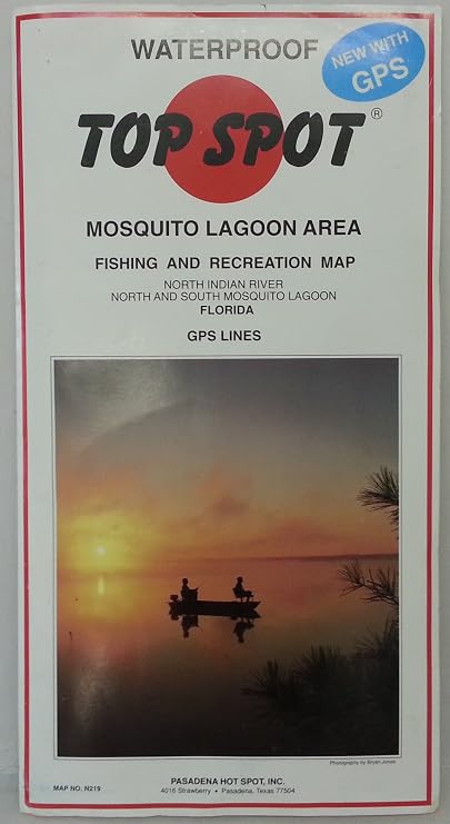
Topspot N219 Map- Mosquito LagoonN Indian River N&S Mosquito Lagoon
Item #:
578435
ETB 5417
Price Details
Excluding Shipping & Custom charges ( Shipping and custom charges will be calculated on checkout )
*All items will import from US
0 ratings
Write a review
In stock
 Imported from USA store
QTY:
Order now and get it around Tuesday, September 08
Secured transaction
Ubuy works hard to protect your security and privacy. Our advanced payment security system ensures confidentiality by encrypting your information during transmission using AES (Advanced Encryption Standards) and SSL (Secure Socket Layer) protocols. Your payment details are 100% secure as we do not share your payment details with third party sellers.
Our Top Logistics Partners


Top Spot Fishing Maps are waterproof and include detailed information and GPS coordinates for prime fishing locations.

Fast
Shipping

Free
Return*

Secure Packaging

100% Original Products

PCI DSS Compliance

ISO 27001 Certified



Note: Step Down Voltage Transformer required for using electronics products of US store (110-120). Recommended power converters Buy Now.


What Stands Out
Detailed Navigation
Topspot N219 Map offers extensive charts of Mosquito Lagoon, ideal for anglers and boaters to navigate waters safely, ensuring accurate routes and optimal fishing spots.
Durable Material
Crafted with high-quality waterproof and tear-resistant materials, this map withstands tough marine conditions, ensuring long-term use without wear or damage.
User-Friendly Design
The map's clear, intuitive layout allows for quick reference, making it easy for users of all experience levels to plan their fishing or boating trips effectively.
Product Details
Who Should Buy?

-
Fishing Enthusiasts
Ideal for anglers seeking detailed navigation aids in the Mosquito Lagoon and Indian River areas.
-
Boating Users
Perfect for boaters needing accurate charts for safe and enjoyable exploration of local waterways.
-
Nature Explorers
Useful for wildlife enthusiasts wanting to navigate and discover the ecosystems around Mosquito Lagoon.

-
Casual Users
Not suitable for occasional navigators who do not require detailed maps for specific areas.
Product Description
Topspot N219 Map- Mosquito LagoonN Indian River N&S Mosquito Lagoon
Have any Query? Chat with us
Customer Questions & Answers
-
Question:
What is the Top Spot N219 Map designed for?
Answer: The Top Spot N219 Map is specifically created for boaters, anglers, and outdoor enthusiasts exploring the Mosquito Lagoon and Indian River areas. It features detailed nautical charts, including depth contours, navigational aids, and points of interest, helping users navigate these waters safely and effectively. This map not only enhances your fishing experience by highlighting fishing hotspots but also provides valuable information about the local ecosystem. Users can easily locate popular areas for fishing or boating, making it an essential tool for both novice and experienced adventurers. -
Question:
What features does the Top Spot N219 Map offer?
Answer: The Top Spot N219 Map includes high-quality graphics that are easy to read and navigate, alongside comprehensive details about underwater structures, tidal information, and local wildlife. With color-coded regions and clear symbols, it allows users to quickly identify key features, making it a vital addition to any fishing or boating trip. Additionally, it supports recreational activities like kayaking and paddleboarding, providing valuable insights for all types of water activities. This detailed mapping is critical for anyone looking to enhance their outdoor experiences. -
Question:
Is the Top Spot N219 Map waterproof?
Answer: Yes, the Top Spot N219 Map is printed on water-resistant material, ensuring durability and longevity, even in wet conditions. This feature is particularly important for outdoor enthusiasts who may encounter rain or splashes while boating or fishing. The water-resistant design allows the map to withstand exposure to water without losing any clarity or important information. Anglers and boaters appreciate that this quality enhances usability, making it a reliable resource during outdoor adventures. -
Question:
Can I use the Top Spot N219 Map for navigation?
Answer: Absolutely, the Top Spot N219 Map is designed for navigation and is filled with essential navigational markers, depth contours, and landmarks. It is compatible for use with GPS devices, adding another layer of utility for those who prefer a blended approach to navigation. This map helps users avoid hazards, find channels, and even locate good fishing spots. Users often report increased confidence in their navigating skills when equipped with this detailed map. -
Question:
What areas are covered by the Top Spot N219 Map?
Answer: The Top Spot N219 Map comprehensively covers the Mosquito Lagoon and both the northern and southern reaches of the Indian River. Its detailed layout includes key fishing spots, islands, and navigational aids throughout the area. Whether you’re fishing or exploring, you can easily identify your location and plan routes according to the various points of interest. This thorough coverage ensures users are well-prepared for their outdoor excursions. -
Question:
Who should use the Top Spot N219 Map?
Answer: The Top Spot N219 Map is ideal for fishermen, recreational boaters, and anyone interested in exploring the waterways of Mosquito Lagoon and the Indian River. Whether you're a novice angler looking to learn about local fishing spots or an experienced boater needing precise navigational details, this map is tailored to meet your needs. Additionally, environmental enthusiasts can appreciate the map's insights into local ecosystems. It bridges the gap between recreational fun and informed exploration. -
Question:
What makes the Top Spot N219 Map unique?
Answer: What sets the Top Spot N219 Map apart is its focus on local details and user-friendly layout. Unlike standard maps, it highlights specific fishing areas, underwater structures, and important geographical features that are crucial for outdoor activities. The map integrates local knowledge that is not readily available through general maps, making it a vital resource for serious anglers and boaters alike. This localized information allows users to take full advantage of their outdoor adventures. -
Question:
How can the Top Spot N219 Map enhance my fishing experience?
Answer: The Top Spot N219 Map can significantly enhance your fishing experience by providing insights into prime fishing locations, depth drops, and areas where fish are likely to congregate. Detailed information about local tides and currents helps anglers plan their trips effectively, ensuring they are at the right spot at the right time. The map encourages a more productive and enjoyable fishing trip, making it a valuable asset for both casual outings and serious fishing endeavors. -
Question:
Is the Top Spot N219 Map suitable for beginners?
Answer: Yes, the Top Spot N219 Map is highly suitable for beginners. Its clear graphics, easy-to-read information, and highlighted fishing areas make it accessible for those new to boating or fishing. The map serves as a learning tool, helping users understand the layout of the waters and improving their navigation skills. Beginners can easily follow the recommendations on the map to find great fishing spots, building their confidence in exploring the Mosquito Lagoon and Indian River area. -
Question:
Where can I buy the Top Spot N219 Map in Ethiopia?
Answer: You can purchase the Top Spot N219 Map at Ubuy. Ubuy offers a convenient online platform where you can find this detailed map along with various other outdoor and recreational products. By shopping at Ubuy, you can ensure that you have access to quality items that cater to your outdoor adventure needs, allowing you to plan your excursions effectively.
Topspot Charts & Maps Editorial Review
The N219 Map for Mosquito Lagoon and Indian River North & South has garnered a positive reception among users, particularly those who appreciate the utility of traditional navigation tools. Customers have praised its detailed representation of the waters, noting that it is an effective guide for both experienced boaters and novices looking to learn the area. One reviewer particularly highlights its value as a cost-effective alternative to expensive GPS and depth finder combinations, reinforcing the notion that it offers great practicality for around $20. Enthusiasts of nautical navigation have noted the map's accuracy and comprehensiveness, making it a cherished tool for those who are familiar with the challenges of charting areas like Mosquito Lagoon. One user even emphasizes that the map is essential for studying the area prior to outings on the boat. Despite one initial shipping mishap, which was addressed effectively by the company, the overall sentiment reflects a strong endorsement of the product's quality and usefulness. Overall, the feedback highlights that the N219 Map is a valuable resource for navigating Mosquito Lagoon and the surrounding Indian River area. It stands out for its thoughtful design and accurate information, appealing especially to those who prefer a traditional approach to navigation over digital alternatives. **
Customer Reviews & Ratings
1 customers ratings
-
5 Star
100%
-
4 Star
0%
-
3 Star
0%
-
2 Star
0%
-
1 Star
0%
Review this product
Share your thoughts with other customers
Pros
- Highly detailed and accurate representation of Mosquito Lagoon
- Cost-effective compared to GPS and depth finder options
- Well-suited for both beginners and experienced boaters
- Provides a comprehensive overview of the area
Cons
- Primarily for basic navigation and may not suffice for advanced charting needs
Platform Trust & Buyer Confidence

MA
Mohammad
Verified buyer
“Excellent quality and original too,when ubuy send original things I will appreciate that ,I very satisfied thank you”
23 July 2026 · via Trustpilot
CK
Chitra
Verified buyer
“The order and delivery progress was communicated very well. Package arrived within the estimated time. Products arrived as expected in good condition.”
22-Jul-26 · via Trustpilot
K
kund
Verified buyer
“Good supply of products. Safe payment methods, and shipment worldwide! Genuine products.”
23-Jul-26 · via Trustpilot
OO
Onesi
Verified buyer
“Was my first time buying a product from Ubuy, but I found it so helpful. This is reliable. Gonna place a new order!”
22 July 2026 · via Trustpilot
SJ
SAO JOHN
Verified buyer
“Ubuy is a great online platform to buy stuff. Reliable, fast delivery time and great value for money. I've been using Ubuy online shopping platform for three years now and will continue to do so.”
23 July 2026 · via Trustpilot
Secure Checkout
Global Delivery
Easy Returns
Genuine Products
Product Price History
Important information
- Limitations : For products shipped internationally, please note that any manufacturer warranty may not be valid; manufacturer service options may not be available; product manuals, instructions, and safety warnings may not be in destination country languages; the products (and accompanying materials) may not be designed in accordance with destination country standards, specifications, and labeling requirements; and the products may not conform to destination country voltage and other electrical standards (requiring use of an adapter or converter if appropriate). The recipient is responsible for assuring that the product can be lawfully imported to the destination country. When ordering from Ubuy or its affiliates, the recipient is the importer of record and must comply with all laws and regulations of the destination country.
- Not all the products listed on Ubuy are for sale, as Ubuy is a global search engine. Products are subject to export/trade regulations.
ETB 5417
Order now and get it around Tuesday, September 08
This item is not restrict in my country.(Please click on above link if this item is not restrict in your country, So our team will review and allow.)
QTY:
Secured transaction
PCI DSS compliant and ISO 27001:2022 certified, with encrypted payments and full buyer protection on every order.
Our Top Logistics Partners
Fastest cross-border delivery
Features & Benefits
- Waterproof maps designed for fishing enthusiasts.
- Includes freshwater, inshore saltwater, and offshore saltwater areas.
- Provides detailed information and GPS coordinates.
- Features boat ramps, marinas, and other points of interest.
- Convenient package dimensions and lightweight for easy transport.
- Perfect for enhancing your fishing experience.
Ubuy Assurance
Experience worry-free shopping with 100% original products, PCI DSS-compliant payment security, ISO 27001-certified data protection, the fastest cross-border delivery, free returns *, and secure packaging on every order.